- Efficient and safe view of stock
- How drone technology is changing stock measurement
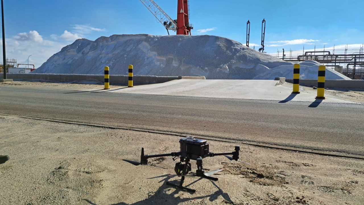
Where measuring equipment and manpower were once required, today a fifteen-minute drone flight suffices. At INEOS Inovyn in Lillo, mapping the salt stock has been carried out using drone technology for a year now. "Whereas it used to take hours to estimate our salt stock, we now have an accurate measurement in less than fifteen minutes," says Matthias Van Biervliet, Logistics Team Leader at INEOS Inovyn.
The switch to drone measurements was an innovative but also well-considered choice. Drones can map large areas, such as salt mountains, quickly and efficiently. The salt mountains on the INEOS Inovyn site are ideal for this. "We also avoid the risk of falls and collapses. This fits in perfectly with our safety policy," adds Van Biervliet. "We check our stock every two weeks."
The drone is equipped with an advanced sensor that creates highly accurate 3D models of the salt stockpile, enabling accurate stock calculations. "This also increases the reliability of our stock figures. We're not doing this to show off new technology," concludes Van Biervliet. "We're doing this because it works."
That technology comes from Dronecheck, an Antwerp-based inspection company that has been active in the industrial and maritime sector since 2017. Founder Filip Schepens was one of the first drone pilots in Belgium. For the measurements at INEOS Inovyn, Dronecheck uses a DJI M350 with L2 LiDAR. This drone can withstand light drizzle, so that stocks can be checked even in bad weather.
The salt is delivered to INEOS Inovyn by ship and is an essential raw material in production. Through electrolysis, sodium chloride (salt) is converted into chlorine, caustic soda and hydrogen. Chlorine, in turn, is a basic product for numerous applications, from plastics production to water purification.
